Geolocate

Lufkin topographic map

Click on the map to display elevation.

About this map

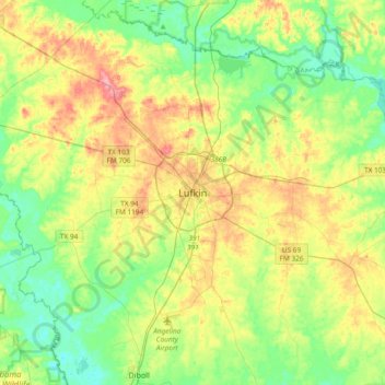
Name: Lufkin topographic map, elevation, terrain.

Location: Lufkin, Angelina County, Texas, 75902, USA (31.17862 -94.88886 31.49862 -94.56886)

Average elevation: 253 ft

Minimum elevation: 131 ft

Maximum elevation: 459 ft

Gear up for your next adventure:

🗺️NatGeo Topo Maps - High-quality waterproof printed topographic maps of US Parks
🦟Ultrasonic Repellers - Create a bug-free zone at your camp or rest stop
🌧️Backpack Rain Cover - Keep gear dry in wet weather
🥾Men's Hiking Boots - Durable, waterproof footwear for rugged terrain and steep inclines
🎒Hydration Pack - Hands‑free water reservoir for long hikes

As an Amazon Associate, this site earns from qualifying purchases at no extra cost to you.