
Make a donation
Gear up for your next adventure:
As an Amazon Associate, this site earns from qualifying purchases at no extra cost to you.
Wüstegarten topographic map
Click on the map to display elevation.
Make a donation
Gear up for your next adventure:
As an Amazon Associate, this site earns from qualifying purchases at no extra cost to you.
Wüstegarten
Der Wüstegarten wird von den linken Schwalm-Zuflüssen Urff im Norden und Gilsa im Süden und Osten und vom linken Gilsa-Zufluss Norde im Südwesten begrenzt. Jenseits bzw. südlich der Gilsa schließt sich die Oberhessische Schwelle mit dem Höhenzug Hemberg an.
Make a donation
Gear up for your next adventure:
As an Amazon Associate, this site earns from qualifying purchases at no extra cost to you.
About this map
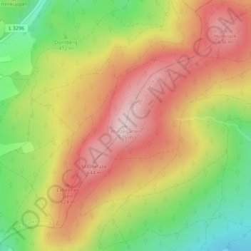
Name: Wüstegarten topographic map, elevation, terrain.
Average elevation: 1,709 ft
Minimum elevation: 1,148 ft
Maximum elevation: 2,185 ft
Make a donation
Gear up for your next adventure:
As an Amazon Associate, this site earns from qualifying purchases at no extra cost to you.