
Thank you for supporting this site ❤️
Make a donation
Make a donation
Gear up for your next adventure:
As an Amazon Associate, this site earns from qualifying purchases at no extra cost to you.
Kalisatan topographic map
Click on the map to display elevation.
Thank you for supporting this site ❤️
Make a donation
Make a donation
Gear up for your next adventure:
As an Amazon Associate, this site earns from qualifying purchases at no extra cost to you.
About this map
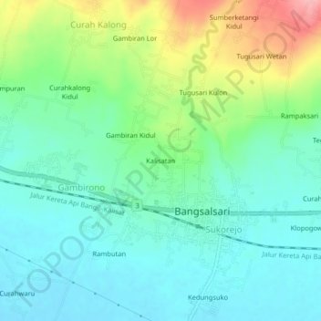
Name: Kalisatan topographic map, elevation, terrain.
Location: Kalisatan, Bangsalsari, Jember, East Java, Java, Indonesia (-8.21484 113.50856 -8.17484 113.54856)
Average elevation: 217 ft
Minimum elevation: 102 ft
Maximum elevation: 499 ft
Thank you for supporting this site ❤️
Make a donation
Make a donation
Gear up for your next adventure:
As an Amazon Associate, this site earns from qualifying purchases at no extra cost to you.