
Shore Acres topographic map
Click on the map to display elevation.
About this map
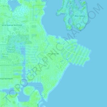
Name: Shore Acres topographic map, elevation, terrain.
Average elevation: 7 ft
Minimum elevation: -3 ft
Maximum elevation: 30 ft
Pinellas County trails, hiking, mountain biking, running and outdoor activities
Other topographic maps
Click on a map to view its topography, its elevation and its terrain.
Fort De Soto County Park
United States > Florida > Pinellas County > Saint Petersburg
Average elevation: 0 ft
Frenchman's Creek
United States > Florida > Pinellas County > Saint Petersburg
Average elevation: 13 ft
Boyd Hill Nature Preserve
United States > Florida > Pinellas County > Saint Petersburg > Lakewood Estates
Average elevation: 23 ft
Boyd Hill Nature Preserve
United States > Florida > Pinellas County > Saint Petersburg > Lakewood Estates
Average elevation: 23 ft