
Thank you for supporting this site ❤️
Make a donation
Make a donation
Gear up for your next adventure:
As an Amazon Associate, this site earns from qualifying purchases at no extra cost to you.
Cingambul topographic map
Click on the map to display elevation.
Thank you for supporting this site ❤️
Make a donation
Make a donation
Gear up for your next adventure:
As an Amazon Associate, this site earns from qualifying purchases at no extra cost to you.
About this map
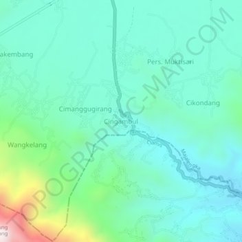
Name: Cingambul topographic map, elevation, terrain.
Location: Cingambul, Majalengka, West Java, Java, Indonesia (-7.07008 108.33385 -7.03008 108.37385)
Average elevation: 2,113 ft
Minimum elevation: 1,496 ft
Maximum elevation: 4,501 ft
Thank you for supporting this site ❤️
Make a donation
Make a donation
Gear up for your next adventure:
As an Amazon Associate, this site earns from qualifying purchases at no extra cost to you.