Geolocate

Suli topographic map

Click on the map to display elevation.

About this map

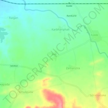
Name: Suli topographic map, elevation, terrain.

Location: Suli, Navapur Taluka, Nandurbar, Maharashtra, 425417, India (21.12245 73.84196 21.16245 73.88196)

Average elevation: 564 ft

Minimum elevation: 463 ft

Maximum elevation: 755 ft

Gear up for your next adventure:

🗃️Trail First Aid Kit - Essential kit for outdoor injuries and emergencies
🪶Fire Starter Kit - Reliable fire starter for survival and camping
🪶Camping Sleeping Pad - Comfortable sleeping pad for backpacking
🧭Pro Hiking Compasses - High-accuracy liquid-filled compasses for topographic orientation
🧭Outdoor Navigation Book - Learn advanced navigation skills

As an Amazon Associate, this site earns from qualifying purchases at no extra cost to you.