
Thank you for supporting this site ❤️
Make a donation
Make a donation
Gear up for your next adventure:
As an Amazon Associate, this site earns from qualifying purchases at no extra cost to you.
Sigsipamba topographic map
Click on the map to display elevation.
Thank you for supporting this site ❤️
Make a donation
Make a donation
Gear up for your next adventure:
As an Amazon Associate, this site earns from qualifying purchases at no extra cost to you.
About this map
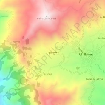
Name: Sigsipamba topographic map, elevation, terrain.
Location: Sigsipamba, Chillanes, Bolívar, Ecuador (-1.96262 -79.09890 -1.92262 -79.05890)
Average elevation: 8,143 ft
Minimum elevation: 6,339 ft
Maximum elevation: 9,583 ft
Thank you for supporting this site ❤️
Make a donation
Make a donation
Gear up for your next adventure:
As an Amazon Associate, this site earns from qualifying purchases at no extra cost to you.