Geolocate

Key Largo topographic map

Click on the map to display elevation.

About this map

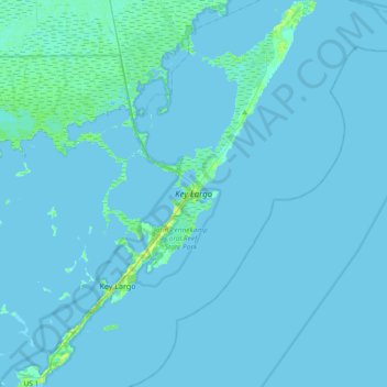
Name: Key Largo topographic map, elevation, terrain.

Location: Key Largo, Monroe County, Florida, 33070, United States (24.99939 -80.54337 25.33498 -80.25651)

Average elevation: 3 ft

Minimum elevation: -3 ft

Maximum elevation: 43 ft

Monroe County trails, hiking, mountain biking, running and outdoor activities

Other topographic maps

Click on a map to view its topography, its elevation and its terrain.

Sunset Point

United States > Florida > Monroe County > Key Largo

Average elevation: 3 ft

Newport

United States > Florida > Monroe County > Key Largo

Average elevation: 7 ft

Gear up for your next adventure:

🚪Portable Camp Chair - Foldable chair for comfort at camp
🪶Survival Guide Book - Expert advice for emergency preparedness
🧯Emergency Survival Kit - All‑in‑one survival essentials for the backcountry
🪶Compact Camp Shovel - Folding shovel for campsite tasks
🧴Hand Sanitizer - Keep hands clean while hiking

As an Amazon Associate, this site earns from qualifying purchases at no extra cost to you.