Geolocate

Kongad topographic map

Click on the map to display elevation.

About this map

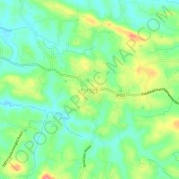
Name: Kongad topographic map, elevation, terrain.

Location: Kongad, Palakkad, Palakkad District, Kerala, 678631, India (10.83477 76.50206 10.87477 76.54206)

Average elevation: 328 ft

Minimum elevation: 226 ft

Maximum elevation: 512 ft

Other topographic maps

Click on a map to view its topography, its elevation and its terrain.

Mallapuram Kulam

India > Kerala > Palakkad

Average elevation: 230 ft

Gear up for your next adventure:

🧣Merino Neck Gaiters - Multi-functional headwear for wind and sun protection
🧦Merino Wool Socks - Moisture-wicking, blister-preventing socks for long treks
🗻Climbing Gear Basics - Essential gear for beginner climbers
🪶Thermal Camp Blanket - Extra warmth for cold nights
🕶️Glacier Sunglasses - Side shields to protect eyes from high-altitude snow glare

As an Amazon Associate, this site earns from qualifying purchases at no extra cost to you.