Geolocate

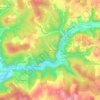
46150 topographic map

Click on the map to display elevation.

About this map

Name: 46150 topographic map, elevation, terrain.

Location: 46150, Catus, Cahors, Lot, Occitanie, France métropolitaine, France (44.55921 1.32023 44.55931 1.32033)

Average elevation: 758 ft

Minimum elevation: 502 ft

Maximum elevation: 958 ft

Other topographic maps

Click on a map to view its topography, its elevation and its terrain.

La Sole

France > Occitanie > Lot > Catus

Average elevation: 781 ft

La Berrie

France > Occitanie > Lot > Catus

Average elevation: 732 ft

Salvezou

France > Occitanie > Lot > Catus

Average elevation: 896 ft

Gear up for your next adventure:

🪶Fire Starter Kit - Reliable fire starter for survival and camping
📻Weather Alert Radios - Stay informed of storm risks while off-the-grid
🦶Hiking Gaiters - Keep debris and water out of your boots
💧Water Filtration Bottles - Safely drink from streams and lakes while exploring
🛰️Satellite Messengers - Emergency SOS and two-way messaging for off-grid adventures

As an Amazon Associate, this site earns from qualifying purchases at no extra cost to you.