
Thank you for supporting this site ❤️
Make a donation
Make a donation
Gear up for your next adventure:
As an Amazon Associate, this site earns from qualifying purchases at no extra cost to you.
Garbaharey topographic map
Click on the map to display elevation.
Thank you for supporting this site ❤️
Make a donation
Make a donation
Gear up for your next adventure:
As an Amazon Associate, this site earns from qualifying purchases at no extra cost to you.
About this map
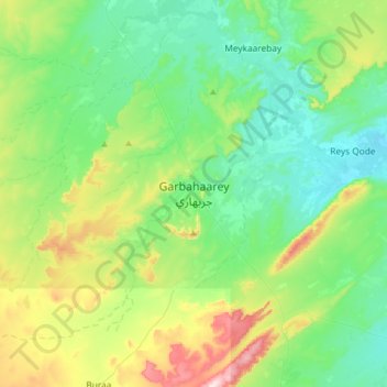
Name: Garbaharey topographic map, elevation, terrain.
Location: Garbaharey, Garbaharey District, Gedo, Jubaland, Somalia (3.16802 42.05990 3.48802 42.37990)
Average elevation: 823 ft
Minimum elevation: 515 ft
Maximum elevation: 1,677 ft
Thank you for supporting this site ❤️
Make a donation
Make a donation
Gear up for your next adventure:
As an Amazon Associate, this site earns from qualifying purchases at no extra cost to you.