
Rabodanges topographic map
Interactive map
Click on the map to display elevation.
About this map
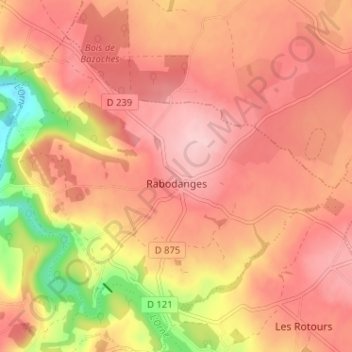
Name: Rabodanges topographic map, elevation, terrain.
Average elevation: 617 ft
Minimum elevation: 236 ft
Maximum elevation: 797 ft
Other topographic maps
Click on a map to view its topography, its elevation and its terrain.
Lac de Rabodanges
France > Normandie > Orne > Putanges-le-Lac > Sainte-Croix-sur-Orne
Average elevation: 577 ft
Fromentel
France > Normandie > Orne > Putanges-le-Lac > La Fresnaye-au-Sauvage
Average elevation: 751 ft
Les Courtils
France > Normandie > Orne > Putanges-le-Lac > Putanges-Pont-Écrepin
Average elevation: 610 ft
Le Hamel
France > Normandie > Orne > Putanges-le-Lac > La Forêt-Auvray > Le Hamel
Average elevation: 568 ft