
Make a donation
Gear up for your next adventure:
As an Amazon Associate, this site earns from qualifying purchases at no extra cost to you.
Halls topographic map
Click on the map to display elevation.
Make a donation
Gear up for your next adventure:
As an Amazon Associate, this site earns from qualifying purchases at no extra cost to you.
About this map
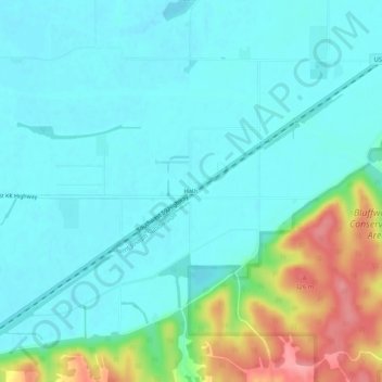
Name: Halls topographic map, elevation, terrain.
Location: Halls, Buchanan County, Missouri, United States (39.61333 -94.99330 39.65333 -94.95330)
Average elevation: 860 ft
Minimum elevation: 784 ft
Maximum elevation: 1,109 ft
Buchanan County trails, hiking, mountain biking, running and outdoor activities
Make a donation
Gear up for your next adventure:
As an Amazon Associate, this site earns from qualifying purchases at no extra cost to you.
Other topographic maps
Click on a map to view its topography, its elevation and its terrain.
Dearborn Reservoir Dam
United States > Missouri > Buchanan County > Dearborn
Average elevation: 948 ft
Make a donation
Gear up for your next adventure:
As an Amazon Associate, this site earns from qualifying purchases at no extra cost to you.