Geolocate

Wawa topographic map

Click on the map to display elevation.

About this map

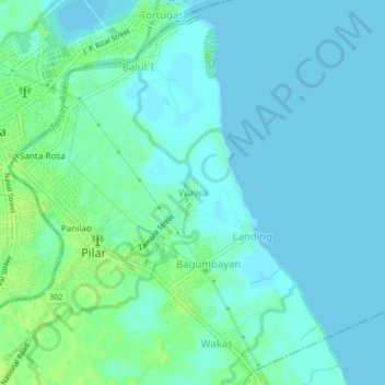
Name: Wawa topographic map, elevation, terrain.

Location: Wawa, Pilar, Bataan, Central Luzon, 2101, Philippines (14.65317 120.54349 14.69317 120.58349)

Average elevation: 13 ft

Minimum elevation: 0 ft

Maximum elevation: 36 ft

Gear up for your next adventure:

🧭Compass with Lanyard - Easy‑carry compass for navigation
🪵Folding Camp Saw - Compact saw for wood and campsite work
📚USA Hiking Guide Books - Top trail guides and map books
🧣Hiking Neck Gaiter - Multi‑use neck protection for outdoor weather
🔊Portable Camp Speaker - Music and alerts at camp

As an Amazon Associate, this site earns from qualifying purchases at no extra cost to you.