
Edmonton topographic map
Interactive map
Click on the map to display elevation.
About this map
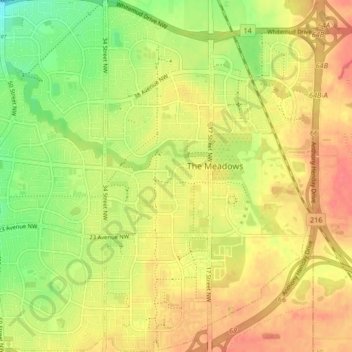
Name: Edmonton topographic map, elevation, terrain.
Location: The Meadows, Edmonton, Alberta, Canada (53.43757 -113.39395 53.48719 -113.34400)
Average elevation: 2,346 ft
Minimum elevation: 2,241 ft
Maximum elevation: 2,425 ft
Other topographic maps
Click on a map to view its topography, its elevation and its terrain.
Avenue District
Avenue District, Edmonton, Alberta, Canada
Average elevation: 2,175 ft
Lake District
Lake District, Edmonton, Alberta, Canada
Average elevation: 2,244 ft
The Hamptons
The Hamptons, The Grange, Edmonton, Alberta, Canada
Average elevation: 2,297 ft