
Thank you for supporting this site ❤️
Make a donation
Make a donation
Gear up for your next adventure:
As an Amazon Associate, this site earns from qualifying purchases at no extra cost to you.
Stradbroke topographic map
Click on the map to display elevation.
Thank you for supporting this site ❤️
Make a donation
Make a donation
Gear up for your next adventure:
As an Amazon Associate, this site earns from qualifying purchases at no extra cost to you.
About this map
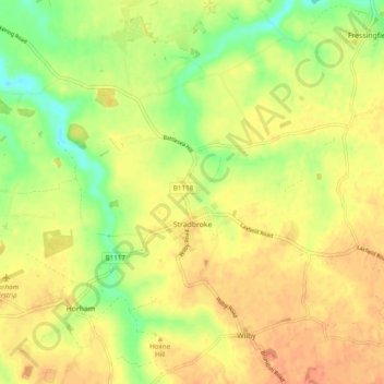
Name: Stradbroke topographic map, elevation, terrain.
Location: Stradbroke, Mid Suffolk, Suffolk, England, United Kingdom (52.29885 1.24391 52.34609 1.34104)
Average elevation: 164 ft
Minimum elevation: 89 ft
Maximum elevation: 213 ft
Thank you for supporting this site ❤️
Make a donation
Make a donation
Gear up for your next adventure:
As an Amazon Associate, this site earns from qualifying purchases at no extra cost to you.