
Make a donation
Gear up for your next adventure:
As an Amazon Associate, this site earns from qualifying purchases at no extra cost to you.
Real topographic map
Click on the map to display elevation.
Make a donation
Gear up for your next adventure:
As an Amazon Associate, this site earns from qualifying purchases at no extra cost to you.
About this map
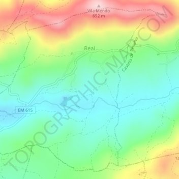
Name: Real topographic map, elevation, terrain.
Location: Real, Penalva do Castelo, Viseu, Portugal (40.62418 -7.69802 40.64899 -7.66227)
Average elevation: 1,736 ft
Minimum elevation: 1,447 ft
Maximum elevation: 2,244 ft
Make a donation
Gear up for your next adventure:
As an Amazon Associate, this site earns from qualifying purchases at no extra cost to you.
Other topographic maps
Click on a map to view its topography, its elevation and its terrain.
Make a donation
Gear up for your next adventure:
As an Amazon Associate, this site earns from qualifying purchases at no extra cost to you.
Cantos
Portugal > Viseu > Penalva do Castelo > Castelo de Penalva > Cantos
Average elevation: 1,716 ft