
Blanchardville topographic map
Interactive map
Click on the map to display elevation.
About this map
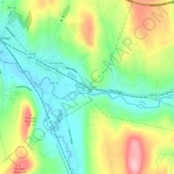
Name: Blanchardville topographic map, elevation, terrain.
Average elevation: 512 ft
Minimum elevation: 299 ft
Maximum elevation: 856 ft
Hampden County trails, hiking, mountain biking, running and outdoor activities
Other topographic maps
Click on a map to view its topography, its elevation and its terrain.
Forest Lake
United States > Massachusetts > Hampden County > Palmer > Whipples
Average elevation: 489 ft
Three Rivers Well Field
United States > Massachusetts > Hampden County > Palmer > Four Corners
Average elevation: 361 ft