Geolocate

Maner topographic map

Click on the map to display elevation.

About this map

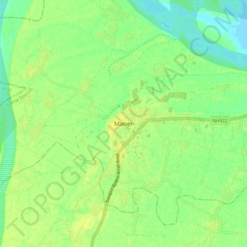
Name: Maner topographic map, elevation, terrain.

Location: Maner, Patna District, Bihar, 801108, India (25.60665 84.83634 25.68665 84.91634)

Average elevation: 177 ft

Minimum elevation: 144 ft

Maximum elevation: 200 ft

Gear up for your next adventure:

🧯Portable Fire Pit - Compact fire pit for camping spots
🧺Microfiber Travel Towels - Compact and fast-drying towels for trail use
🎒Trail Energy Bars - High‑calorie bars for hiking energy
👖Convertible Hiking Pants - Versatile zip-off pants for changing altitudes and temperatures
🪶Trail Camera - Capture wildlife on your hikes

As an Amazon Associate, this site earns from qualifying purchases at no extra cost to you.