Geolocate

Umri topographic map

Interactive map

Click on the map to display elevation.

About this map

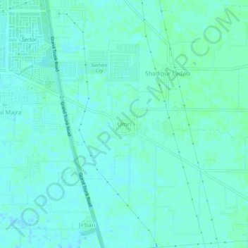
Name: Umri topographic map, elevation, terrain.

Location: Umri, Thanesar, Kurukshetra District, Haryana, 136118, India (29.92660 76.88889 29.96660 76.92889)

Average elevation: 850 ft

Minimum elevation: 840 ft

Maximum elevation: 856 ft

Other topographic maps

Click on a map to view its topography, its elevation and its terrain.

Pindarsi

India > Haryana > Thanesar

Pindarsi, Thanesar, Kurukshetra District, Haryana, India

Average elevation: 820 ft

Chhilchhila WLS

India > Haryana > Thanesar

Chhilchhila WLS, Thanesar, Kurukshetra District, Haryana, India

Average elevation: 820 ft

Kamoda

India > Haryana > Thanesar

Kamoda, Thanesar, Kurukshetra District, Haryana, India

Average elevation: 823 ft

Jyotisar

India > Haryana > Thanesar

Jyotisar, Thanesar, Kurukshetra, Haryana, 136119, India

Average elevation: 830 ft

Kurukshetra

India > Haryana > Thanesar

Kurukshetra, Thanesar, Kurukshetra District, Haryana, 132118, India

Average elevation: 840 ft