
Thank you for supporting this site ❤️
Make a donation
Make a donation
Gear up for your next adventure:
As an Amazon Associate, this site earns from qualifying purchases at no extra cost to you.
Zeive topographic map
Click on the map to display elevation.
Thank you for supporting this site ❤️
Make a donation
Make a donation
Gear up for your next adventure:
As an Amazon Associate, this site earns from qualifying purchases at no extra cost to you.
About this map
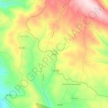
Name: Zeive topographic map, elevation, terrain.
Location: Zeive, Parâmio, Bragança, Distrito de Bragança, Portugal (41.89236 -6.91795 41.93236 -6.87795)
Average elevation: 3,018 ft
Minimum elevation: 2,343 ft
Maximum elevation: 3,652 ft
Thank you for supporting this site ❤️
Make a donation
Make a donation
Gear up for your next adventure:
As an Amazon Associate, this site earns from qualifying purchases at no extra cost to you.