
Mimbres topographic map
Click on the map to display elevation.
About this map
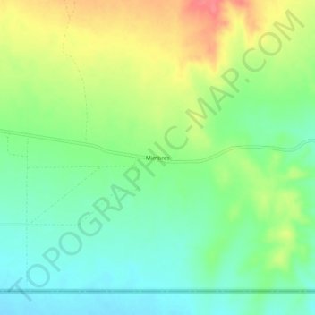
Name: Mimbres topographic map, elevation, terrain.
Location: Mimbres, Luna County, New Mexico, United States (31.78066 -107.77447 31.82066 -107.73447)
Average elevation: 4,354 ft
Minimum elevation: 4,262 ft
Maximum elevation: 4,491 ft
Luna County trails, hiking, mountain biking, running and outdoor activities
Other topographic maps
Click on a map to view its topography, its elevation and its terrain.
Deming
United States > New Mexico > Luna County
Deming is located within the Upper Chihuahuan Desert climate zone. The climate is dry, hot, and breezy. Summer temperatures often exceed 100 °F (38 °C), but the altitude (4,300 feet (1,300 m)) and dry air sometimes make summer days more comfortable than one would expect given the high temperature.
Average elevation: 4,354 ft