
卫东街道 topographic map
Interactive map
Click on the map to display elevation.
About this map
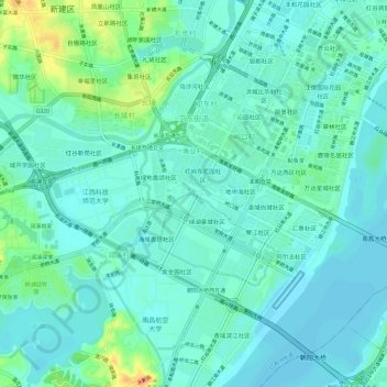
Name: 卫东街道 topographic map, elevation, terrain.
Location: 卫东街道, 渔业村, 红谷滩区, 南昌市, 江西省, 中国 (28.64892 115.80582 28.69218 115.86576)
Average elevation: 72 ft
Minimum elevation: 39 ft
Maximum elevation: 180 ft
Other topographic maps
Click on a map to view its topography, its elevation and its terrain.