
Thank you for supporting this site ❤️
Make a donation
Make a donation
Gear up for your next adventure:
As an Amazon Associate, this site earns from qualifying purchases at no extra cost to you.
Paranesi topographic map
Click on the map to display elevation.
Thank you for supporting this site ❤️
Make a donation
Make a donation
Gear up for your next adventure:
As an Amazon Associate, this site earns from qualifying purchases at no extra cost to you.
About this map
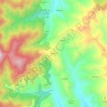
Name: Paranesi topographic map, elevation, terrain.
Location: Paranesi, Rocca Santa Maria, Teramo, Abruzzo, Italia (42.66716 13.48031 42.70716 13.52031)
Average elevation: 3,228 ft
Minimum elevation: 2,402 ft
Maximum elevation: 4,291 ft
Thank you for supporting this site ❤️
Make a donation
Make a donation
Gear up for your next adventure:
As an Amazon Associate, this site earns from qualifying purchases at no extra cost to you.