
Thank you for supporting this site ❤️
Make a donation
Make a donation
Gear up for your next adventure:
As an Amazon Associate, this site earns from qualifying purchases at no extra cost to you.
Kamu topographic map
Click on the map to display elevation.
Thank you for supporting this site ❤️
Make a donation
Make a donation
Gear up for your next adventure:
As an Amazon Associate, this site earns from qualifying purchases at no extra cost to you.
About this map
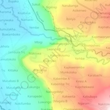
Name: Kamu topographic map, elevation, terrain.
Location: Kamu, Bugisa sub-region, Bulambuli, Eastern Region, Uganda (1.28550 34.30209 1.32550 34.34209)
Average elevation: 4,298 ft
Minimum elevation: 3,543 ft
Maximum elevation: 5,335 ft
Thank you for supporting this site ❤️
Make a donation
Make a donation
Gear up for your next adventure:
As an Amazon Associate, this site earns from qualifying purchases at no extra cost to you.