
Seneca topographic map
Click on the map to display elevation.
Seneca
Seneca is located close to the intersection of River Road (Maryland Route 190), Seneca Road (Maryland route 112), and Rileys Lock Road, east of Great Seneca Creek and north of the Potomac River. The C&O Canal runs along the river, and Riley's Lock is the closest canal lock. The southern portion of Seneca Creek State Park is nearby, as is the Bretton Woods Golf Course. The United States Geological Survey (USGS) lists the community's elevation as 187 feet (57 meters).
About this map
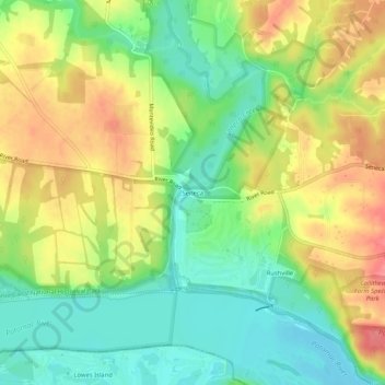
Name: Seneca topographic map, elevation, terrain.
Average elevation: 269 ft
Minimum elevation: 157 ft
Maximum elevation: 400 ft
Montgomery County trails, hiking, mountain biking, running and outdoor activities