Geolocate

Kervily topographic map

Click on the map to display elevation.

About this map
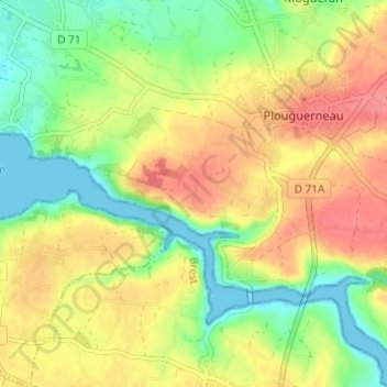
Name: Kervily topographic map, elevation, terrain.

Location: Kervily, Plouguerneau, Brest, Finistère, Bretagne, France métropolitaine, 29880, France (48.57825 -4.54395 48.61825 -4.50395)

Average elevation: 112 ft

Minimum elevation: -3 ft

Maximum elevation: 220 ft

Other topographic maps

Click on a map to view its topography, its elevation and its terrain.

Île Vierge

France > Bretagne > Finistère > Plouguerneau

Average elevation: 0 ft

Gear up for your next adventure:

🌡️Portable Weather Meter - Track weather conditions on the trail
🦶Hiking Gaiters - Keep debris and water out of your boots
💧Water Filtration Bottles - Safely drink from streams and lakes while exploring
🧣Merino Neck Gaiters - Multi-functional headwear for wind and sun protection
🌡️Handheld Weather Meters - Measure wind, temp, and pressure for safe mountain travel

As an Amazon Associate, this site earns from qualifying purchases at no extra cost to you.