
Panikhar topographic map
Interactive map
Click on the map to display elevation.
About this map
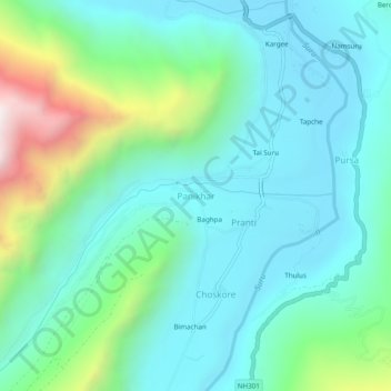
Name: Panikhar topographic map, elevation, terrain.
Location: Panikhar, Sankoo tehsil, Ladakh, India (34.09867 75.92676 34.13867 75.96676)
Average elevation: 11,368 ft
Minimum elevation: 10,515 ft
Maximum elevation: 14,347 ft
Other topographic maps
Click on a map to view its topography, its elevation and its terrain.
Rangdum
India > Ladakh > Sankoo tehsil
Rangdum, Sankoo tehsil, Kargil district, Ladakh, India
Average elevation: 13,543 ft