
Rangdum topographic map
Interactive map
Click on the map to display elevation.
About this map
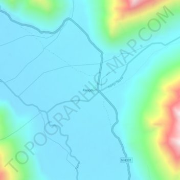
Name: Rangdum topographic map, elevation, terrain.
Location: Rangdum, Sankoo tehsil, Kargil district, Ladakh, India (34.01619 76.35200 34.05619 76.39200)
Average elevation: 13,543 ft
Minimum elevation: 13,084 ft
Maximum elevation: 15,935 ft
Other topographic maps
Click on a map to view its topography, its elevation and its terrain.
Panikhar
India > Ladakh > Sankoo tehsil
Panikhar, Sankoo tehsil, Ladakh, India
Average elevation: 11,368 ft