
Tazrouk topographic map
Interactive map
Click on the map to display elevation.
Tazrouk
Tazrouk is located in the Hoggar mountains at an altitude of 1,827 metres (5,994 ft). Most of the town is located on the east bank of a wadi that runs past the town from the northwest to the southeast.
About this map
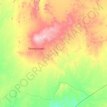
Name: Tazrouk topographic map, elevation, terrain.
Location: Tazrouk, Tazrouk District, Tamanrasset, Algeria (21.04675 5.81136 24.27594 10.27055)
Average elevation: 3,028 ft
Minimum elevation: 1,555 ft
Maximum elevation: 8,907 ft
Other topographic maps
Click on a map to view its topography, its elevation and its terrain.