
Thank you for supporting this site ❤️
Make a donation
Make a donation
Gear up for your next adventure:
As an Amazon Associate, this site earns from qualifying purchases at no extra cost to you.
Aviz topographic map
Click on the map to display elevation.
Thank you for supporting this site ❤️
Make a donation
Make a donation
Gear up for your next adventure:
As an Amazon Associate, this site earns from qualifying purchases at no extra cost to you.
About this map
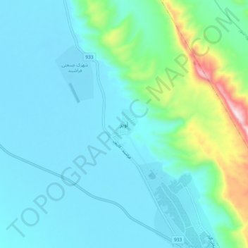
Name: Aviz topographic map, elevation, terrain.
Location: Aviz, بخش مرکزی, Farashband County, Fars Province, Iran (28.87622 52.01721 28.95622 52.09721)
Average elevation: 2,881 ft
Minimum elevation: 2,513 ft
Maximum elevation: 4,829 ft
Thank you for supporting this site ❤️
Make a donation
Make a donation
Gear up for your next adventure:
As an Amazon Associate, this site earns from qualifying purchases at no extra cost to you.