
Fairfield topographic map
Click on the map to display elevation.
About this map
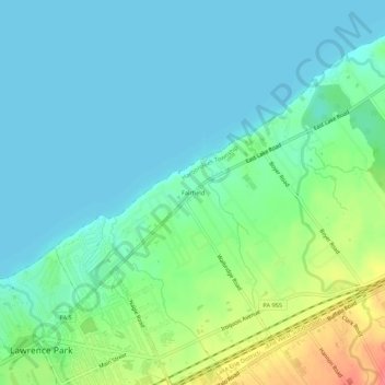
Name: Fairfield topographic map, elevation, terrain.
Average elevation: 620 ft
Minimum elevation: 564 ft
Maximum elevation: 778 ft
Erie County trails, hiking, mountain biking, running and outdoor activities
Other topographic maps
Click on a map to view its topography, its elevation and its terrain.
Northwest Harborcreek
United States > Pennsylvania > Erie County > Harborcreek Township
Average elevation: 722 ft