Geolocate

Goole topographic map

Click on the map to display elevation.

About this map

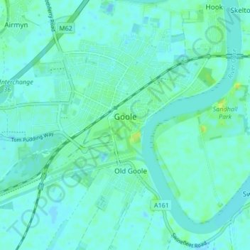
Name: Goole topographic map, elevation, terrain.

Location: Goole, East Riding of Yorkshire, England, United Kingdom (53.68578 -0.90963 53.71855 -0.84205)

Average elevation: 10 ft

Minimum elevation: -7 ft

Maximum elevation: 43 ft

Other topographic maps

Click on a map to view its topography, its elevation and its terrain.

Welton

United Kingdom > England > East Riding of Yorkshire

Average elevation: 128 ft

Gear up for your next adventure:

👟Trail Running Shoes - Lightweight shoes for trail runners
📡GPS Antenna Upgrade - Enhance GPS reception in remote terrain
🩹Survival Bandages - High‑quality bandages for emergencies
🧣Merino Neck Gaiters - Multi-functional headwear for wind and sun protection
🎒Gear Packing Cubes - Organize your backpack efficiently

As an Amazon Associate, this site earns from qualifying purchases at no extra cost to you.