Geolocate

Monroe Center topographic map

Click on the map to display elevation.

About this map

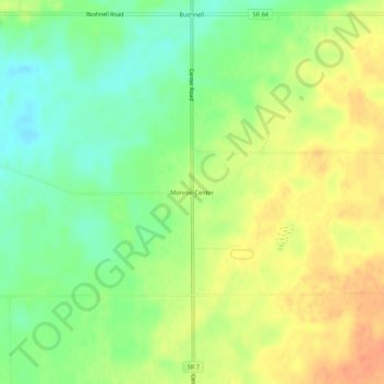
Name: Monroe Center topographic map, elevation, terrain.

Location: Monroe Center, Ashtabula County, Ohio, United States (41.82428 -80.59244 41.86428 -80.55244)

Average elevation: 909 ft

Minimum elevation: 840 ft

Maximum elevation: 978 ft

Ashtabula County trails, hiking, mountain biking, running and outdoor activities

Other topographic maps

Click on a map to view its topography, its elevation and its terrain.

Jefferson

United States > Ohio > Ashtabula County

Average elevation: 935 ft

Roaming Shores

United States > Ohio > Ashtabula County

Average elevation: 883 ft

Rock Creek

United States > Ohio > Ashtabula County

Average elevation: 814 ft

Edgewood

United States > Ohio > Ashtabula County

Average elevation: 702 ft

North Kingsville

United States > Ohio > Ashtabula County

Average elevation: 650 ft

New Lyme Township

United States > Ohio > Ashtabula County

Average elevation: 994 ft

Ashtabula

United States > Ohio > Ashtabula County

Average elevation: 656 ft

Conneaut

United States > Ohio > Ashtabula County

Average elevation: 696 ft

Geneva

United States > Ohio > Ashtabula County

Average elevation: 591 ft

Gear up for your next adventure:

🔭Compact Binoculars - HD vision for scouting terrain and identifying distant landmarks
🌡️Portable Weather Meter - Track weather conditions on the trail
🧭Pro Hiking Compasses - High-accuracy liquid-filled compasses for topographic orientation
📷Action Camera - Capture your outdoor adventures in HD
📶Satellite Messenger - Communication device off‑grid

As an Amazon Associate, this site earns from qualifying purchases at no extra cost to you.