Geolocate

Cascade topographic map

Click on the map to display elevation.

About this map

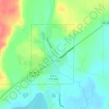
Name: Cascade topographic map, elevation, terrain.

Location: Cascade, Sheboygan County, Wisconsin, United States (43.65247 -88.01539 43.66734 -88.00025)

Average elevation: 906 ft

Minimum elevation: 823 ft

Maximum elevation: 1,073 ft

Sheboygan County trails, hiking, mountain biking, running and outdoor activities

Gear up for your next adventure:

🪶Paracord Bracelet - Survival bracelet with built‑in tools
🛰️Satellite Messengers - Emergency SOS and two-way messaging for off-grid adventures
🏔️Mountain Trail Maps - High‑detail maps for popular peaks
🪶Compact Camp Shovel - Folding shovel for campsite tasks
🌧️Backpack Rain Cover - Keep gear dry in wet weather

As an Amazon Associate, this site earns from qualifying purchases at no extra cost to you.