Geolocate

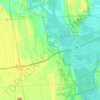
Lodi Center topographic map

Click on the map to display elevation.

About this map

Name: Lodi Center topographic map, elevation, terrain.

Location: Lodi Center, Town of Lodi, Seneca County, New York, 14860, United States (42.55118 -76.84051 42.59118 -76.80051)

Average elevation: 1,276 ft

Minimum elevation: 978 ft

Maximum elevation: 1,578 ft

Seneca County trails, hiking, mountain biking, running and outdoor activities

Other topographic maps

Click on a map to view its topography, its elevation and its terrain.

Town of Ovid

United States > New York > Seneca County

Average elevation: 745 ft

Town of Romulus

United States > New York > Seneca County

The town lies between Cayuga Lake and Seneca Lake at latitude 42° 45' 8" N. and longitude 76° 50' 2" W. at an altitude of 705 ft (214 m).

Average elevation: 614 ft

Town of Lodi

United States > New York > Seneca County

Average elevation: 1,076 ft

Town of Tyre

United States > New York > Seneca County

Average elevation: 440 ft

Gear up for your next adventure:

🏥Hiking First Aid Kits - Comprehensive medical kits for remote trail injuries
🚑Emergency Bivvies - Heat-reflective sleeping bags for survival situations
Solar GPS Watches - Advanced multisport watches with built-in topographic maps
📦Gear Storage Bags - Organize and protect outdoor equipment
🏕️Family Camping Gear - Essentials for group camping trips

As an Amazon Associate, this site earns from qualifying purchases at no extra cost to you.