
Thank you for supporting this site ❤️
Make a donation
Make a donation
Gear up for your next adventure:
As an Amazon Associate, this site earns from qualifying purchases at no extra cost to you.
Máfil topographic map
Click on the map to display elevation.
Thank you for supporting this site ❤️
Make a donation
Make a donation
Gear up for your next adventure:
As an Amazon Associate, this site earns from qualifying purchases at no extra cost to you.
About this map
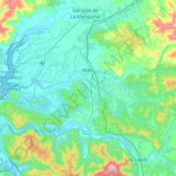
Name: Máfil topographic map, elevation, terrain.
Location: Máfil, Provincia de Valdivia, Los Ríos Region, Chile (-39.81902 -73.09846 -39.59157 -72.59276)
Average elevation: 374 ft
Minimum elevation: -7 ft
Maximum elevation: 2,618 ft
Thank you for supporting this site ❤️
Make a donation
Make a donation
Gear up for your next adventure:
As an Amazon Associate, this site earns from qualifying purchases at no extra cost to you.