Geolocate

Rock Spring topographic map

Click on the map to display elevation.

About this map
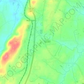
Name: Rock Spring topographic map, elevation, terrain.

Location: Rock Spring, Walker County, Georgia, 30739, United States (34.79916 -85.25599 34.83180 -85.21454)

Average elevation: 863 ft

Minimum elevation: 755 ft

Maximum elevation: 1,040 ft

Walker County trails, hiking, mountain biking, running and outdoor activities

Other topographic maps

Click on a map to view its topography, its elevation and its terrain.
Catlett

United States > Georgia > Walker County

Average elevation: 942 ft

Villanow

United States > Georgia > Walker County

Average elevation: 925 ft

Blowing Spring

United States > Georgia > Walker County

Average elevation: 1,063 ft

White Oak

United States > Georgia > Walker County

Average elevation: 817 ft

Gear up for your next adventure:

🚁Photography Drones - Capture stunning aerial views of landforms and topography
🔋Solar Power Banks - Keep your GPS and phone charged in remote wilderness areas
🚗GPS Dash Cams - Record your scenic drives through mountain passes and canyons
🔌Solar Panel Charger - Charge gear sustainably outdoors
🔦LED Headlamp - Bright and durable LED headlamp for night navigation

As an Amazon Associate, this site earns from qualifying purchases at no extra cost to you.