Geolocate

Maragusan topographic map

Click on the map to display elevation.

About this map

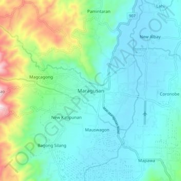
Name: Maragusan topographic map, elevation, terrain.

Location: Maragusan, Davao de Oro, Davao Region, 8808, Philippines (7.27765 126.08265 7.35765 126.16265)

Average elevation: 2,543 ft

Minimum elevation: 2,008 ft

Maximum elevation: 4,495 ft

Other topographic maps

Click on a map to view its topography, its elevation and its terrain.

Laak

Philippines > Davao de Oro

Average elevation: 554 ft

New Bataan

Philippines > Davao de Oro

Average elevation: 2,457 ft

Gear up for your next adventure:

📡Handheld GPS Device - Reliable handheld GPS for outdoor navigation
📖Nature Tracking Books - Learn to track wildlife and terrain
❄️Traction Cleats - Prevent slips on icy trails during winter hikes
🧭Hiking Compass - Precision compass for reliable navigation in the wilderness
🔌Solar Panel Charger - Charge gear sustainably outdoors

As an Amazon Associate, this site earns from qualifying purchases at no extra cost to you.