
Thank you for supporting this site ❤️
Make a donation
Make a donation
Gear up for your next adventure:
As an Amazon Associate, this site earns from qualifying purchases at no extra cost to you.
Damer topographic map
Click on the map to display elevation.
Thank you for supporting this site ❤️
Make a donation
Make a donation
Gear up for your next adventure:
As an Amazon Associate, this site earns from qualifying purchases at no extra cost to you.
About this map
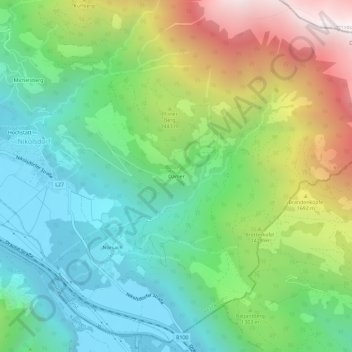
Name: Damer topographic map, elevation, terrain.
Location: Damer, Gemeinde Nikolsdorf, Bezirk Lienz, Tyrol, 9782, Austria (46.76296 12.91263 46.80296 12.95263)
Average elevation: 4,009 ft
Minimum elevation: 2,044 ft
Maximum elevation: 7,851 ft
Thank you for supporting this site ❤️
Make a donation
Make a donation
Gear up for your next adventure:
As an Amazon Associate, this site earns from qualifying purchases at no extra cost to you.