
Thank you for supporting this site ❤️
Make a donation
Make a donation
Gear up for your next adventure:
As an Amazon Associate, this site earns from qualifying purchases at no extra cost to you.
Sidikalang topographic map
Click on the map to display elevation.
Thank you for supporting this site ❤️
Make a donation
Make a donation
Gear up for your next adventure:
As an Amazon Associate, this site earns from qualifying purchases at no extra cost to you.
About this map
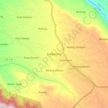
Name: Sidikalang topographic map, elevation, terrain.
Location: Sidikalang, Dairi, North Sumatra, 22211, Indonesia (2.71848 98.25852 2.79848 98.33852)
Average elevation: 3,330 ft
Minimum elevation: 2,123 ft
Maximum elevation: 4,534 ft
Thank you for supporting this site ❤️
Make a donation
Make a donation
Gear up for your next adventure:
As an Amazon Associate, this site earns from qualifying purchases at no extra cost to you.