
Thank you for supporting this site ❤️
Make a donation
Make a donation
Gear up for your next adventure:
As an Amazon Associate, this site earns from qualifying purchases at no extra cost to you.
Conchucos topographic map
Click on the map to display elevation.
Thank you for supporting this site ❤️
Make a donation
Make a donation
Gear up for your next adventure:
As an Amazon Associate, this site earns from qualifying purchases at no extra cost to you.
About this map
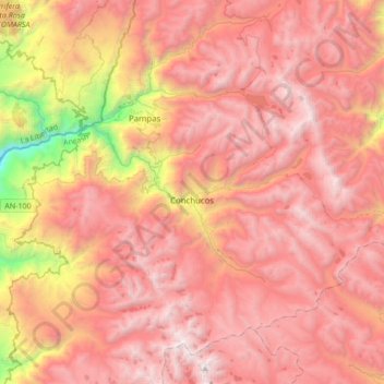
Name: Conchucos topographic map, elevation, terrain.
Location: Conchucos, Pallasca, Ancash, Peru (-8.40331 -77.89797 -8.11750 -77.55684)
Average elevation: 12,746 ft
Minimum elevation: 6,122 ft
Maximum elevation: 16,562 ft
Thank you for supporting this site ❤️
Make a donation
Make a donation
Gear up for your next adventure:
As an Amazon Associate, this site earns from qualifying purchases at no extra cost to you.