Geolocate

Pueblo topographic map

Click on the map to display elevation.

About this map

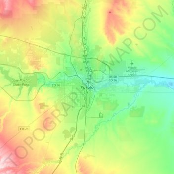
Name: Pueblo topographic map, elevation, terrain.

Location: Pueblo, Pueblo County, Colorado, 81003, United States (38.09445 -104.76914 38.41445 -104.44914)

Average elevation: 4,951 ft

Minimum elevation: 4,524 ft

Maximum elevation: 5,797 ft

Pueblo County trails, hiking, mountain biking, running and outdoor activities

Gear up for your next adventure:

🖼️Topo Map Wall Art - Decorative topographic prints of famous peaks and regions
🦺Reflective Outdoor Gear - Safety gear for low‑light conditions
🗃️Trail First Aid Kit - Essential kit for outdoor injuries and emergencies
🗻Climbing Gear Basics - Essential gear for beginner climbers
🧤Hiking Gloves - Protective gloves for rugged trails

As an Amazon Associate, this site earns from qualifying purchases at no extra cost to you.