
Thank you for supporting this site ❤️
Make a donation
Make a donation
Gear up for your next adventure:
As an Amazon Associate, this site earns from qualifying purchases at no extra cost to you.
Towaoc topographic map
Click on the map to display elevation.
Thank you for supporting this site ❤️
Make a donation
Make a donation
Gear up for your next adventure:
As an Amazon Associate, this site earns from qualifying purchases at no extra cost to you.
About this map
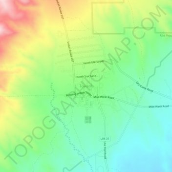
Name: Towaoc topographic map, elevation, terrain.
Location: Towaoc, Montezuma County, Colorado, United States (37.18444 -108.74954 37.22444 -108.70954)
Average elevation: 5,935 ft
Minimum elevation: 5,564 ft
Maximum elevation: 6,594 ft
Montezuma County trails, hiking, mountain biking, running and outdoor activities
Thank you for supporting this site ❤️
Make a donation
Make a donation
Gear up for your next adventure:
As an Amazon Associate, this site earns from qualifying purchases at no extra cost to you.