
Thank you for supporting this site ❤️
Make a donation
Make a donation
Gear up for your next adventure:
As an Amazon Associate, this site earns from qualifying purchases at no extra cost to you.
德钦县 topographic map
Click on the map to display elevation.
Thank you for supporting this site ❤️
Make a donation
Make a donation
Gear up for your next adventure:
As an Amazon Associate, this site earns from qualifying purchases at no extra cost to you.
About this map
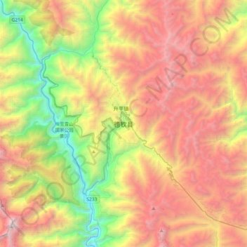
Name: 德钦县 topographic map, elevation, terrain.
Location: 德钦县, 升平镇, 德钦县, 迪庆藏族自治州, 云南省, 中国 (28.30752 98.75706 28.62752 99.07706)
Average elevation: 12,556 ft
Minimum elevation: 6,434 ft
Maximum elevation: 19,419 ft
Thank you for supporting this site ❤️
Make a donation
Make a donation
Gear up for your next adventure:
As an Amazon Associate, this site earns from qualifying purchases at no extra cost to you.