Geolocate

Gardendale topographic map

Click on the map to display elevation.

About this map

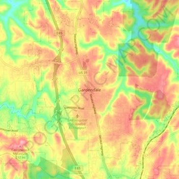
Name: Gardendale topographic map, elevation, terrain.

Location: Gardendale, Jefferson County, Alabama, 35071, United States (33.62010 -86.85277 33.70010 -86.77277)

Average elevation: 594 ft

Minimum elevation: 374 ft

Maximum elevation: 768 ft

Jefferson County trails, hiking, mountain biking, running and outdoor activities

Gear up for your next adventure:

🪓Survival Multi‑Tool - Versatile tool for camp and trail tasks
📦Gear Storage Bags - Organize and protect outdoor equipment
📶Satellite Messenger - Communication device off‑grid
🕶️GPS Smartphone Mount - Secure mount for phone navigation
🛡️Insect Repellent - Protection against bugs during outdoor activities

As an Amazon Associate, this site earns from qualifying purchases at no extra cost to you.