Geolocate

Irvine topographic map

Click on the map to display elevation.

About this map

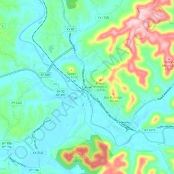
Name: Irvine topographic map, elevation, terrain.

Location: Irvine, Estill County, Kentucky, 40336, United States (37.66064 -84.01381 37.74064 -83.93381)

Average elevation: 794 ft

Minimum elevation: 577 ft

Maximum elevation: 1,450 ft

Estill County trails, hiking, mountain biking, running and outdoor activities

Gear up for your next adventure:

🪶Trail Camera - Capture wildlife on your hikes
🛡️Insect Repellent - Protection against bugs during outdoor activities
🪶LED Camping Lantern - Bright lantern for camp lighting
📦Dry Bags Set - Waterproof storage for electronics and clothes
🛰️Handheld GPS Units - Professional satellite navigators for precise backcountry mapping

As an Amazon Associate, this site earns from qualifying purchases at no extra cost to you.