Geolocate

Villaverde topographic map

Click on the map to display elevation.

About this map

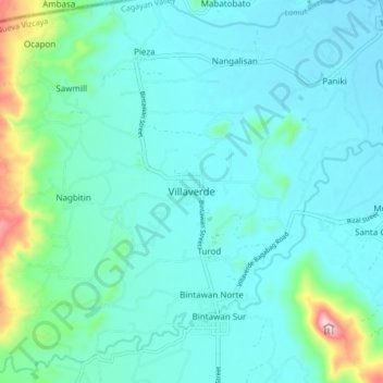
Name: Villaverde topographic map, elevation, terrain.

Location: Villaverde, Nueva Vizcaya, Cagayan Valley, Philippines (16.56506 121.14360 16.64506 121.22360)

Average elevation: 896 ft

Minimum elevation: 702 ft

Maximum elevation: 1,942 ft

Gear up for your next adventure:

🧭Compass with Lanyard - Easy‑carry compass for navigation
🧢Outdoor Hiking Hat - Sun protection hat for outdoor explorers
🧷Carabiner Set - Durable clips for gear attachment
🎒Trail Energy Bars - High‑calorie bars for hiking energy
🪑Ultralight Camp Chairs - Portable seating for resting after a long day of mapping

As an Amazon Associate, this site earns from qualifying purchases at no extra cost to you.