Geolocate

Friedrichstal topographic map

Click on the map to display elevation.

About this map

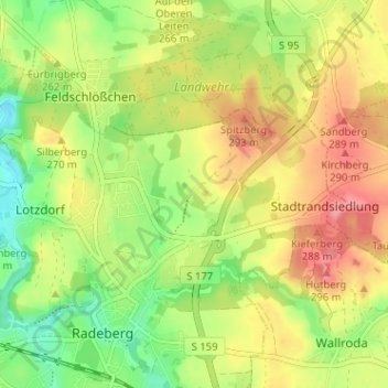
Name: Friedrichstal topographic map, elevation, terrain.

Location: Friedrichstal, Radeberg, Bautzen, Sachsen, 01454, Deutschland (51.10952 13.91266 51.14952 13.95266)

Average elevation: 846 ft

Minimum elevation: 709 ft

Maximum elevation: 981 ft

Gear up for your next adventure:

🧭Outdoor Navigation Book - Learn advanced navigation skills
🧼Biodegradable Camping Soap - Eco‑friendly soap for outdoor hygiene
🛠️Backpacking Tool Kit - Essential toolkit for outdoor repairs
🎒Trekking Poles - Sturdy poles for balance and stability on rough terrain
🧴Hand Sanitizer - Keep hands clean while hiking

As an Amazon Associate, this site earns from qualifying purchases at no extra cost to you.