Geolocate

Balayan topographic map

Click on the map to display elevation.

About this map

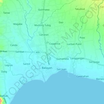
Name: Balayan topographic map, elevation, terrain.

Location: Balayan, Batangas, Calabarzon, 4213, Philippines (13.89820 120.68948 13.97820 120.76948)

Average elevation: 69 ft

Minimum elevation: 0 ft

Maximum elevation: 804 ft

Gear up for your next adventure:

🗺️Topographic Maps - Detailed topo maps for hiking, exploring and outdoor navigation
🔥Camping Stove - Portable stove for camping and backcountry cooking
🌐World Map Poster - Decorative world maps with topographic info
🌲Outdoor Survival Books - Best books on survival skills
📻Weather Alert Radios - Stay informed of storm risks while off-the-grid

As an Amazon Associate, this site earns from qualifying purchases at no extra cost to you.